The Tiberius Map print
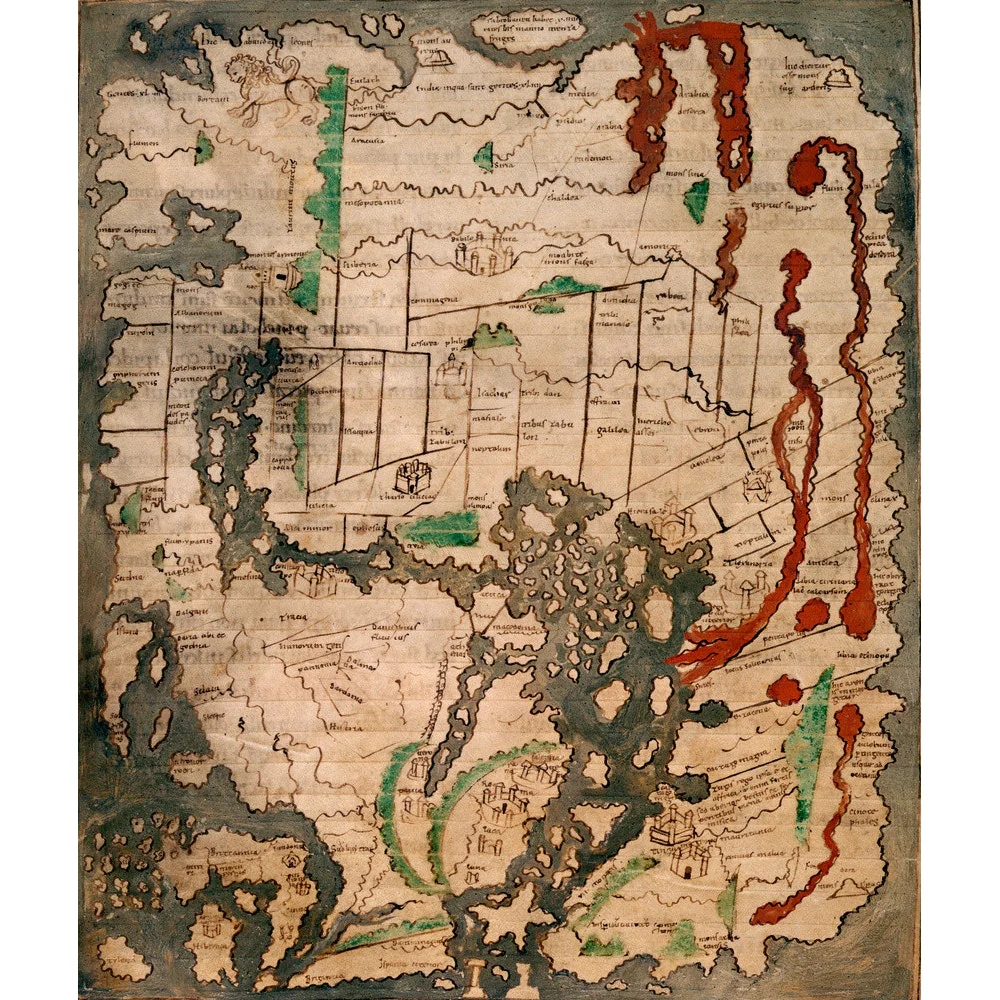
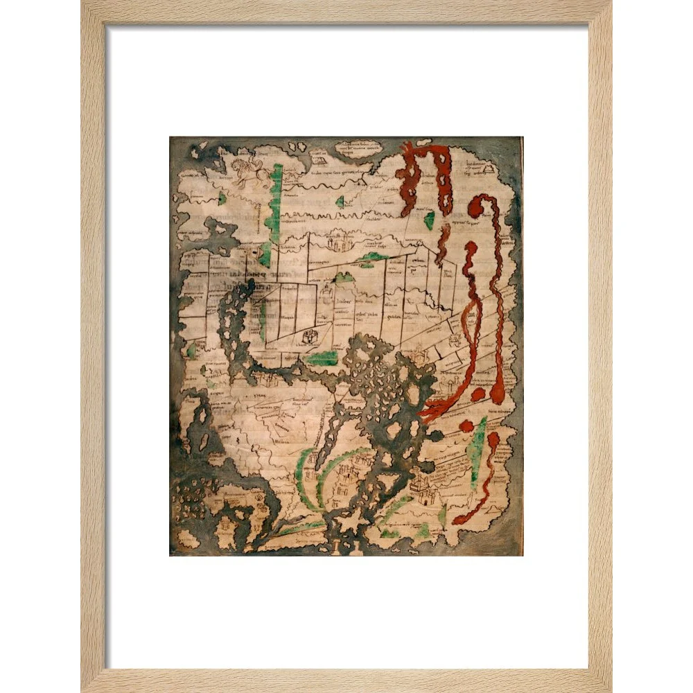
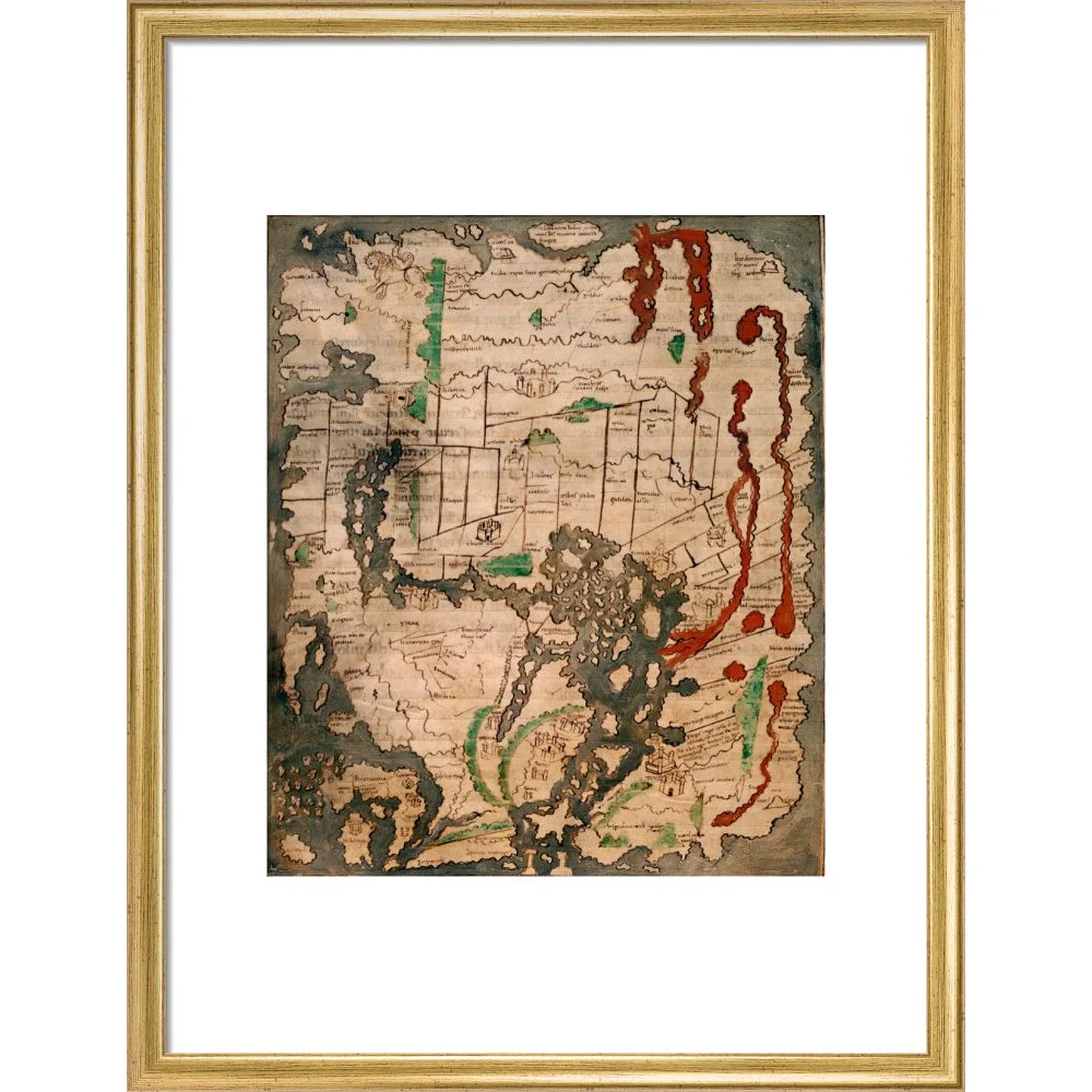
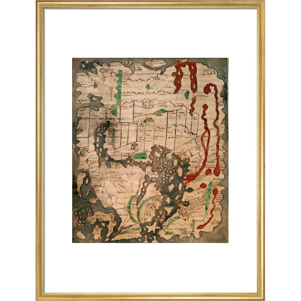
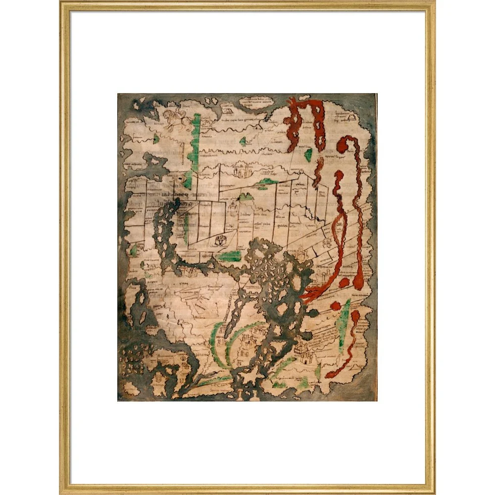
The Tiberius world map or Mappa Mundi is the only surviving world map from Anglo-Saxon England. It is divided into the three continents of Europe, Asia and Africa, with the Mediterranean Sea in the centre. The outline and detail of the British Isles are relatively accurate, with London and Winchester represented as town buildings, and the river Thames and another river indicated. In Ireland, there is the first representation of Armagh, and the Isle of Man, and the Orkney Islands can be identified. The Tiberius map was created in the 11th century, in England. Cotton Tiberius B. V, Part 1
Product Information
Product Information
Shipping & Returns
Shipping & Returns

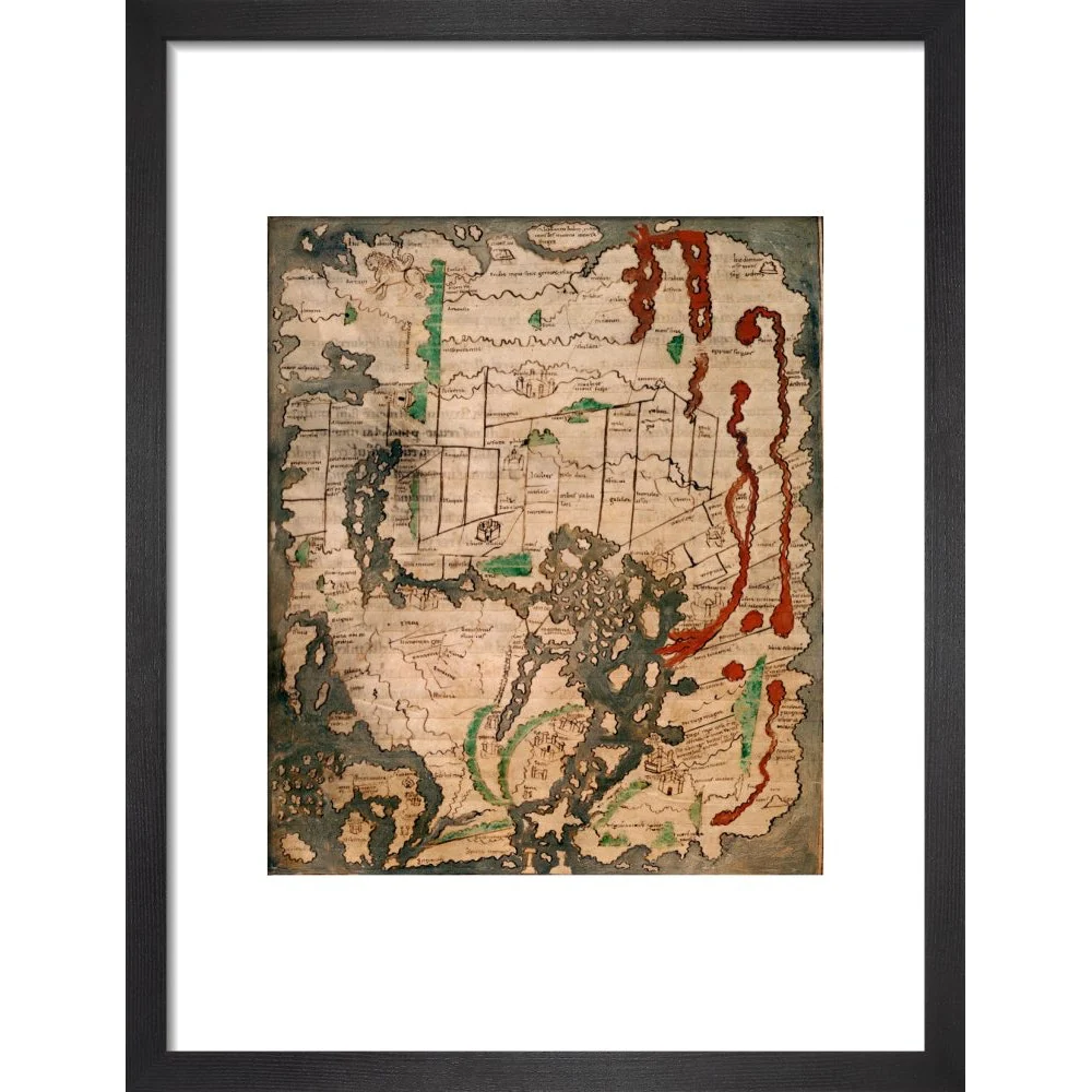


The Tiberius Map print
The Tiberius Map print
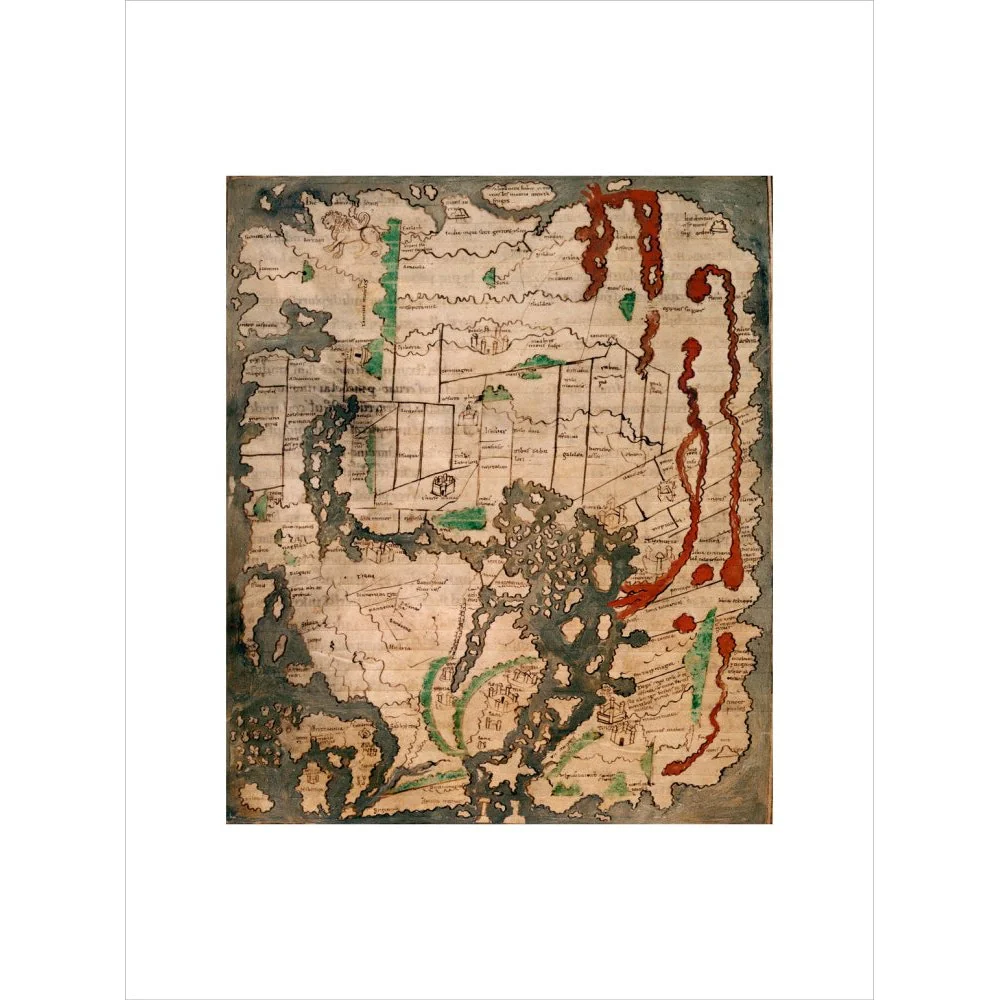
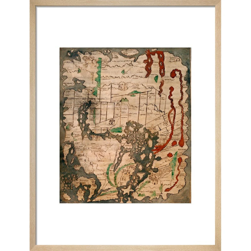
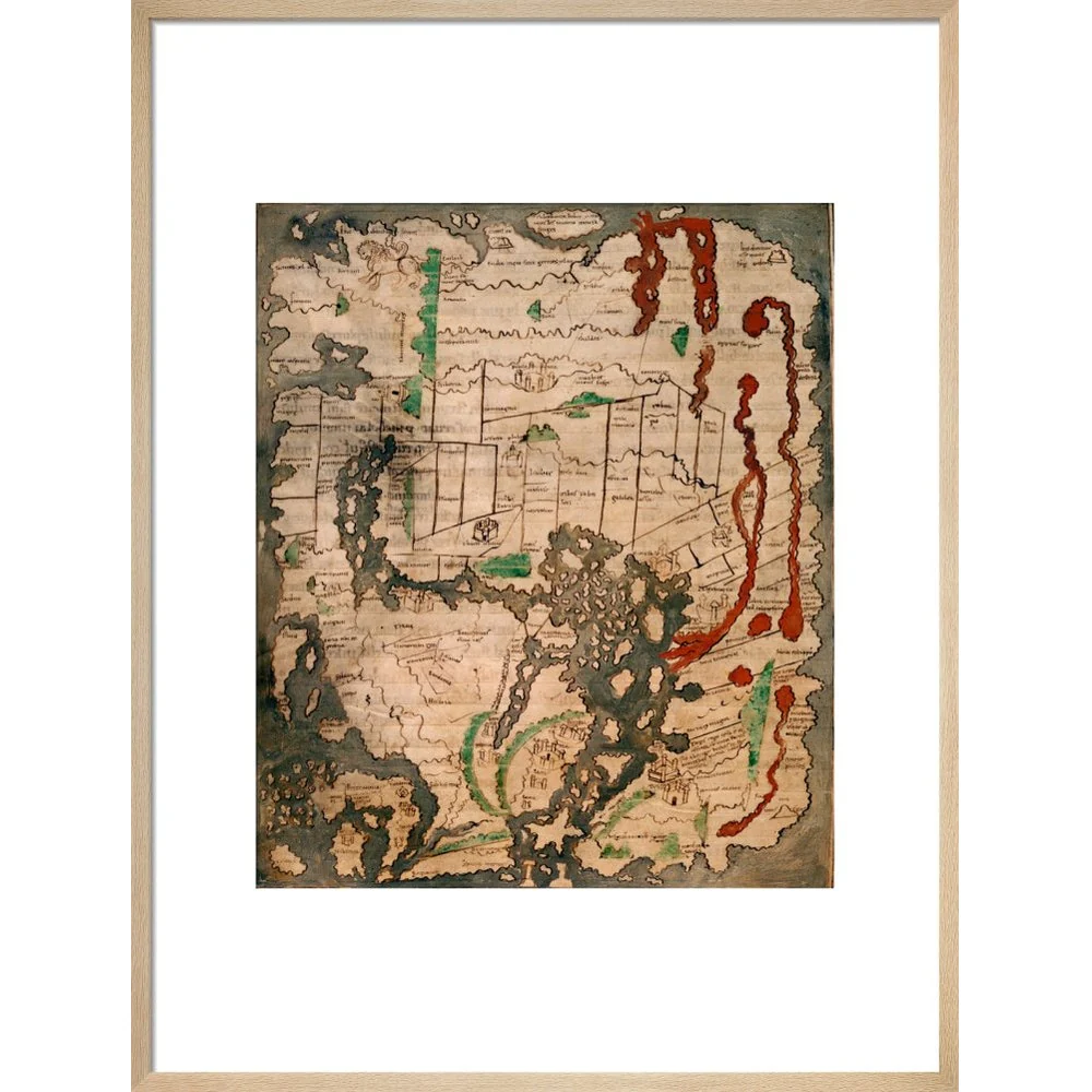
The Tiberius world map or Mappa Mundi is the only surviving world map from Anglo-Saxon England. It is divided into the three continents of Europe, Asia and Africa, with the Mediterranean Sea in the centre. The outline and detail of the British Isles are relatively accurate, with London and Winchester represented as town buildings, and the river Thames and another river indicated. In Ireland, there is the first representation of Armagh, and the Isle of Man, and the Orkney Islands can be identified. The Tiberius map was created in the 11th century, in England. Cotton Tiberius B. V, Part 1
Original: $33.84
-65%$33.84
$11.84Product Information
Product Information
Shipping & Returns
Shipping & Returns
Description
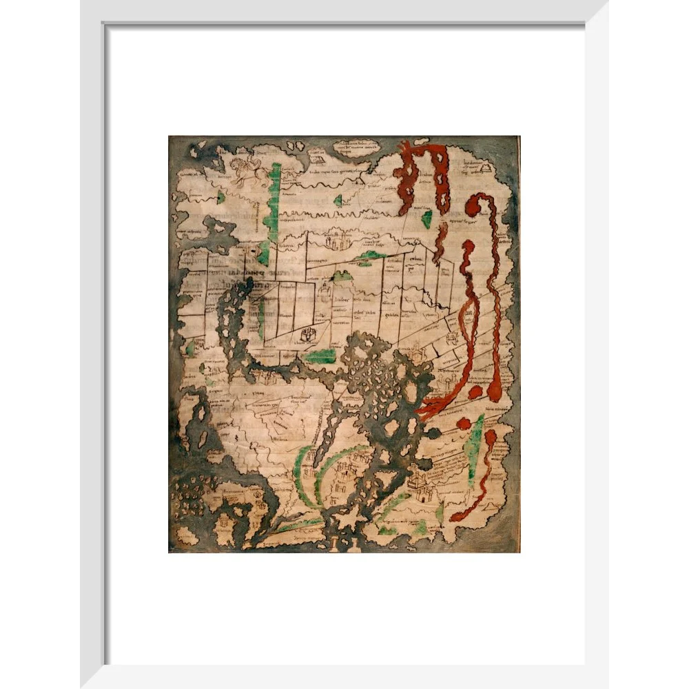
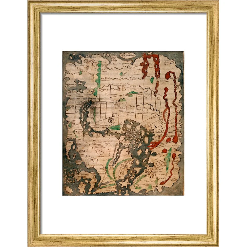
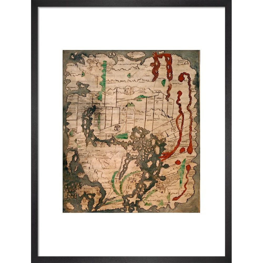
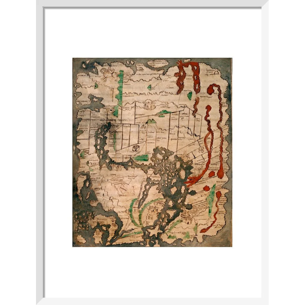
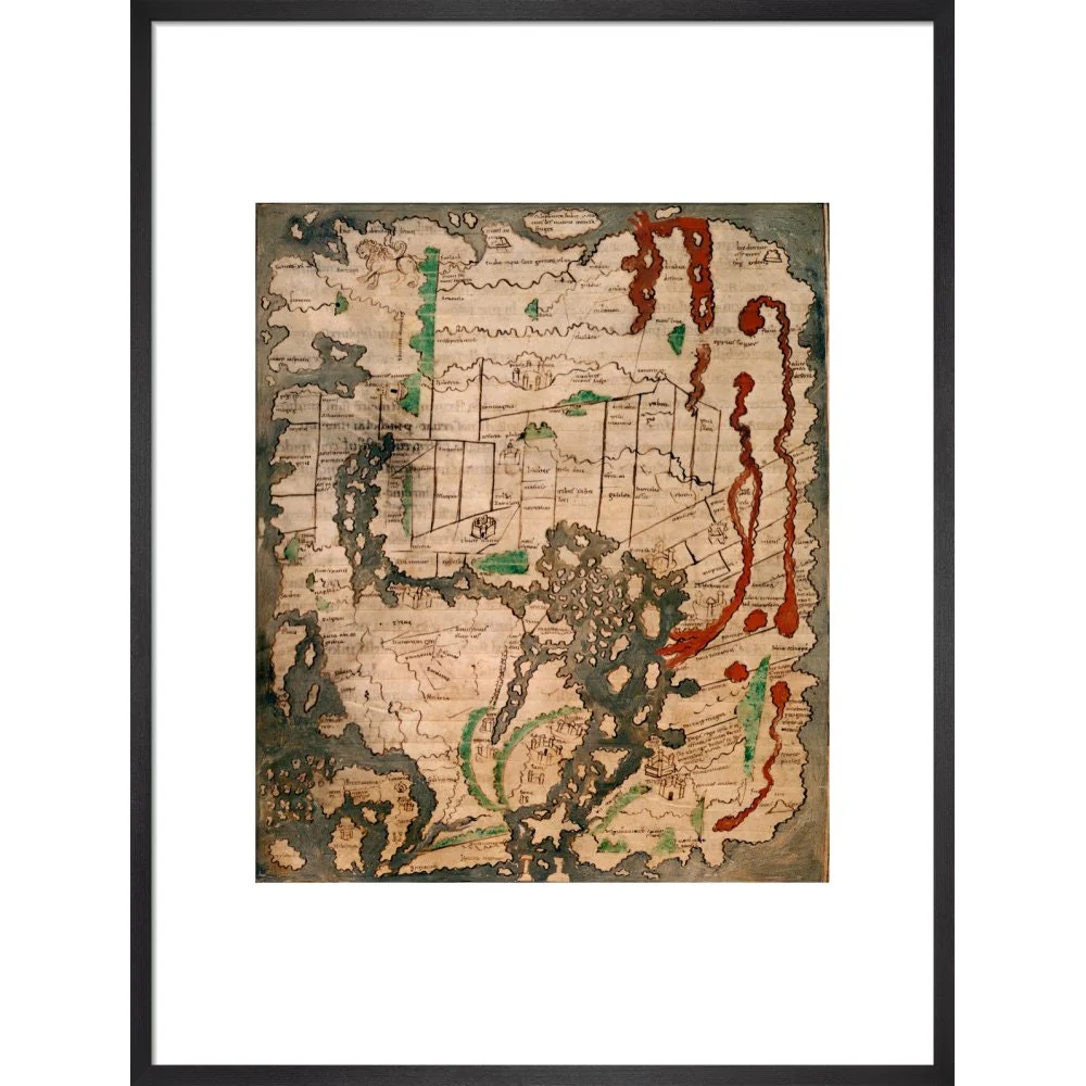
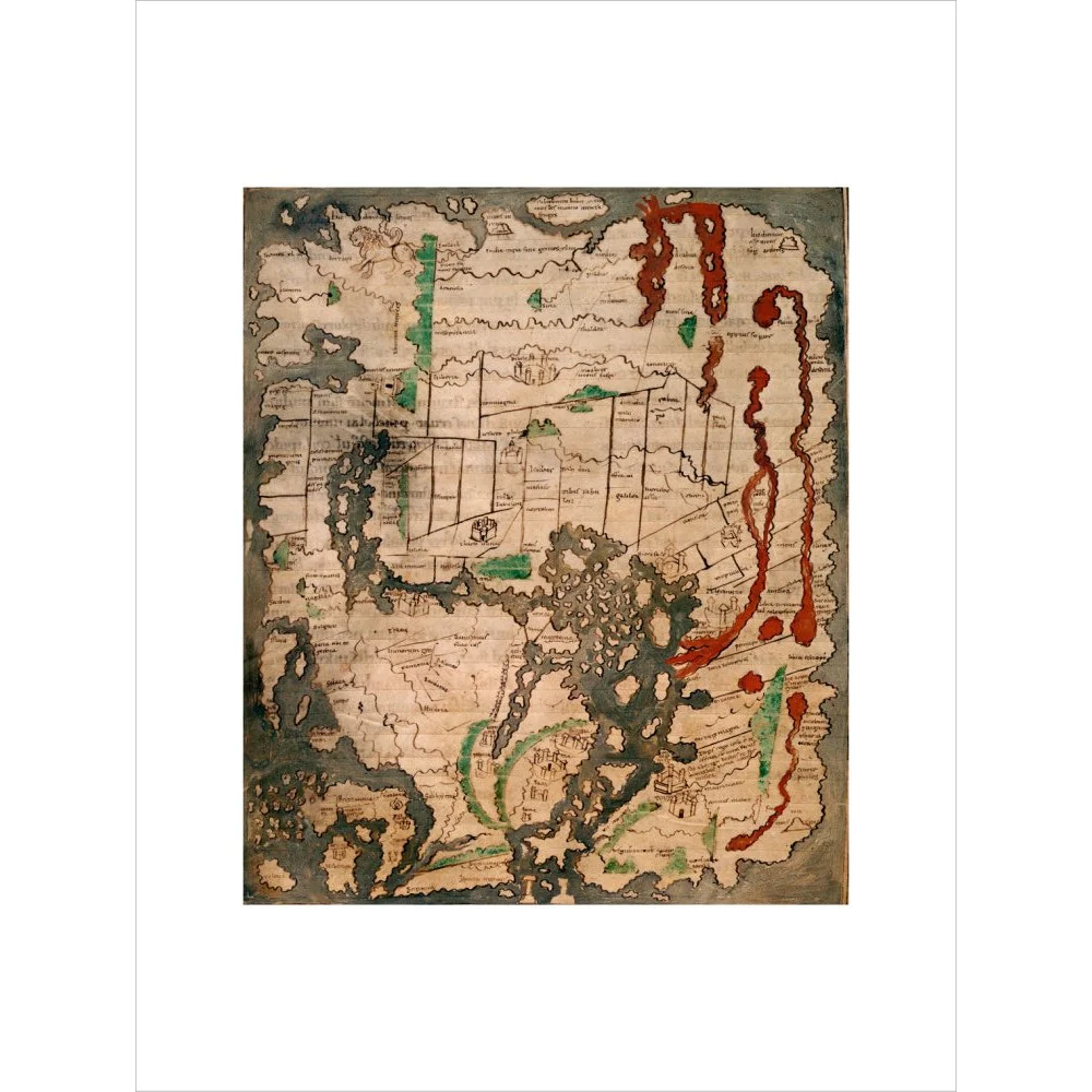
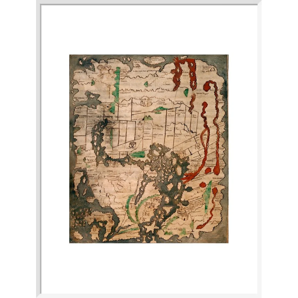
The Tiberius world map or Mappa Mundi is the only surviving world map from Anglo-Saxon England. It is divided into the three continents of Europe, Asia and Africa, with the Mediterranean Sea in the centre. The outline and detail of the British Isles are relatively accurate, with London and Winchester represented as town buildings, and the river Thames and another river indicated. In Ireland, there is the first representation of Armagh, and the Isle of Man, and the Orkney Islands can be identified. The Tiberius map was created in the 11th century, in England. Cotton Tiberius B. V, Part 1