🚚 Free Worldwide Shipping on All Orders!Shop Now
1862 map of London with bus and cab routes print
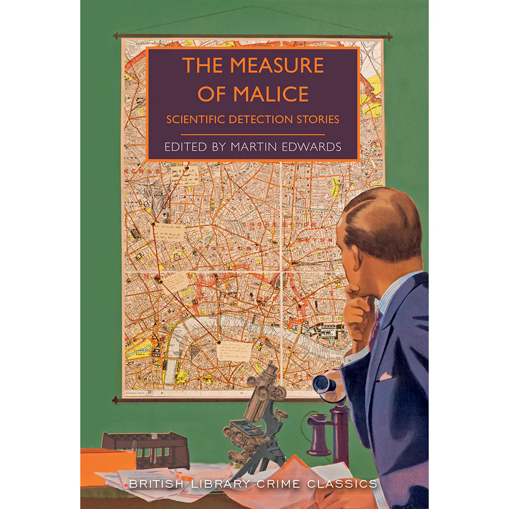
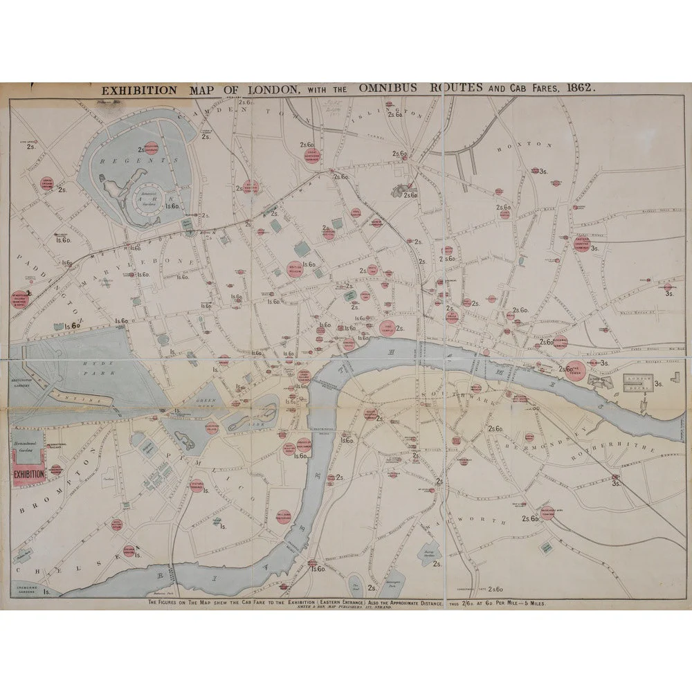
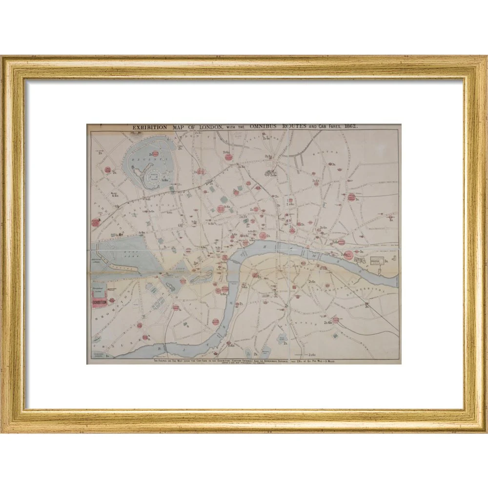
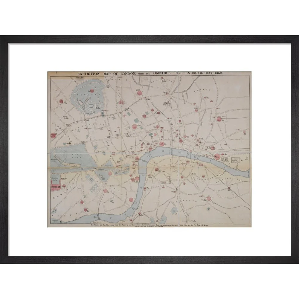
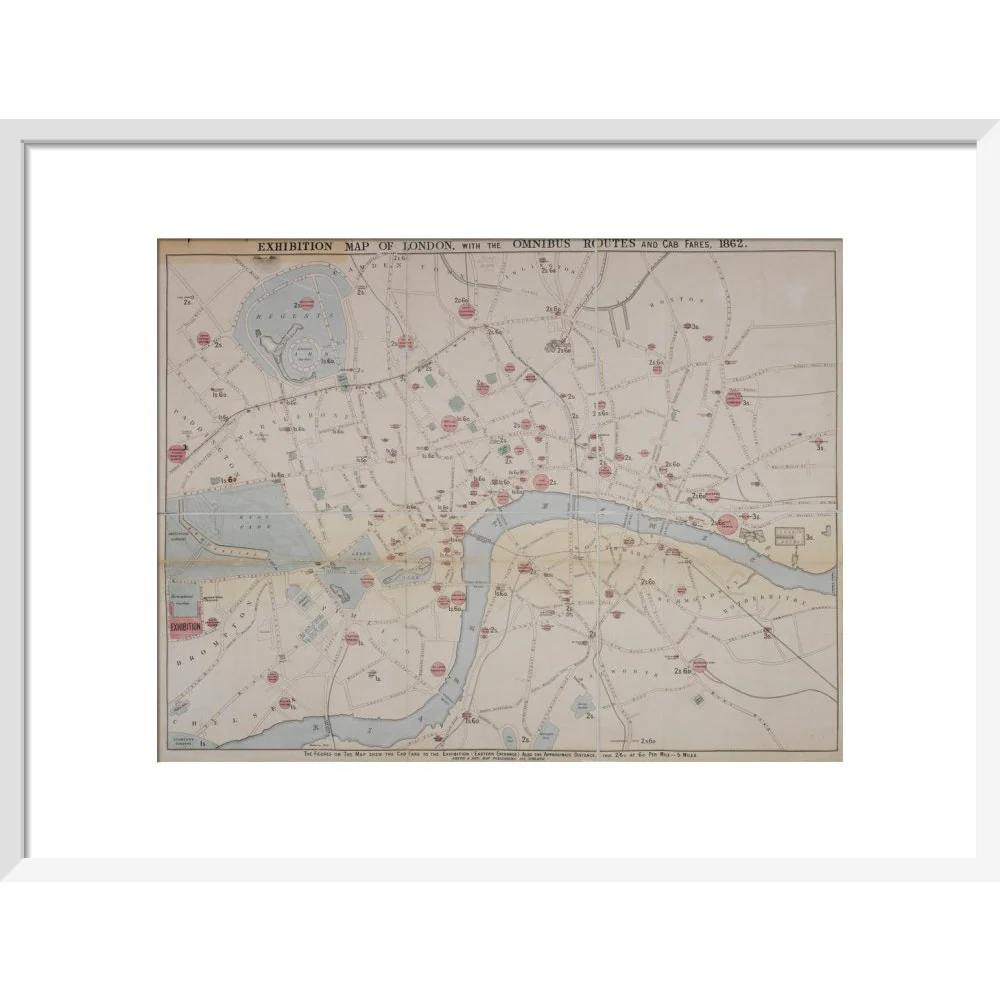
This 1862 map of London is entitled 'An exhibition map of London, with Omnibus routes and cab fares, 1862'. It covers London from Regent's Park in the north to the Oval at Vauxhall in the South, and Kensington Gardens in the West. to the London Docks and Thames Tunnel in the East. Other locations marked include the British Museum, Lambeth Palace, Bethlehem Hospital, Victoria Theatre, Covent Gardens, National Gallery, London University, M. Tussaud's exhibition, Custom House and St Paul's Cathedral. The text along the bottom of the maps reads: The figures on the map shew the cab fare to the exhibition (Eastern entrance) also the approximate distance, thus 2/6 D. at 6D. per mile = 5 miles. The map was produced by Smith & Son, map publishers. Maps.3485.(21.)
Product Information
Product Information
Shipping & Returns
Shipping & Returns


1862 map of London with bus and cab routes print
1862 map of London with bus and cab routes print
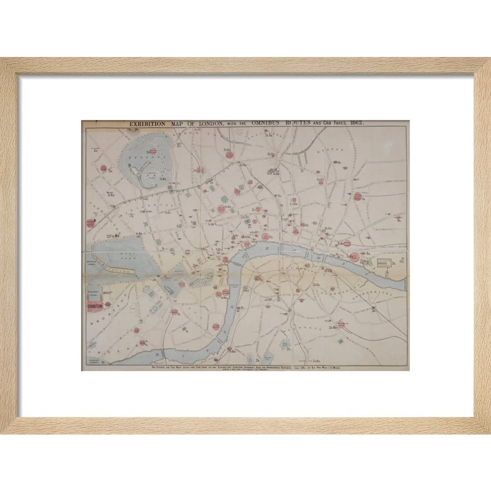
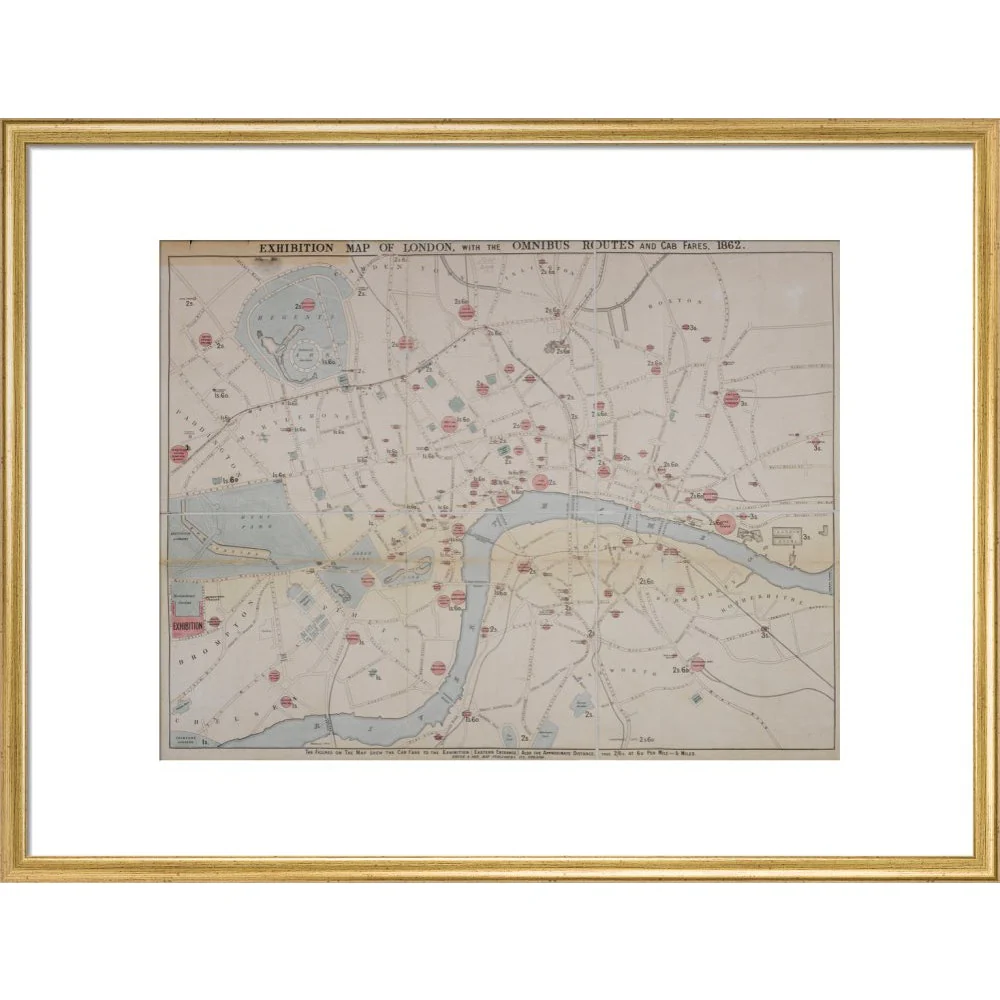
This 1862 map of London is entitled 'An exhibition map of London, with Omnibus routes and cab fares, 1862'. It covers London from Regent's Park in the north to the Oval at Vauxhall in the South, and Kensington Gardens in the West. to the London Docks and Thames Tunnel in the East. Other locations marked include the British Museum, Lambeth Palace, Bethlehem Hospital, Victoria Theatre, Covent Gardens, National Gallery, London University, M. Tussaud's exhibition, Custom House and St Paul's Cathedral. The text along the bottom of the maps reads: The figures on the map shew the cab fare to the exhibition (Eastern entrance) also the approximate distance, thus 2/6 D. at 6D. per mile = 5 miles. The map was produced by Smith & Son, map publishers. Maps.3485.(21.)
Select Type
Select Size
Select Frame
From $11.84
Original: $33.84
-65%1862 map of London with bus and cab routes print—
$33.84
$11.84Product Information
Product Information
Shipping & Returns
Shipping & Returns
Description
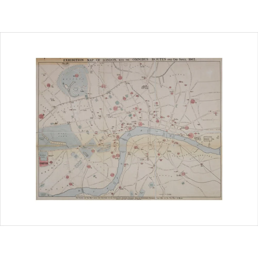
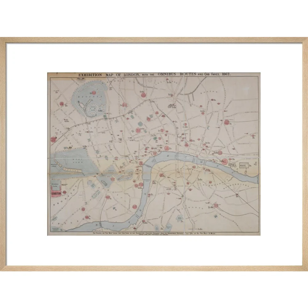
This 1862 map of London is entitled 'An exhibition map of London, with Omnibus routes and cab fares, 1862'. It covers London from Regent's Park in the north to the Oval at Vauxhall in the South, and Kensington Gardens in the West. to the London Docks and Thames Tunnel in the East. Other locations marked include the British Museum, Lambeth Palace, Bethlehem Hospital, Victoria Theatre, Covent Gardens, National Gallery, London University, M. Tussaud's exhibition, Custom House and St Paul's Cathedral. The text along the bottom of the maps reads: The figures on the map shew the cab fare to the exhibition (Eastern entrance) also the approximate distance, thus 2/6 D. at 6D. per mile = 5 miles. The map was produced by Smith & Son, map publishers. Maps.3485.(21.)