🚚 Free Worldwide Shipping on All Orders!Shop Now
Chart of the Society Islands print
Chart of the Society Islands, with Otaheite [Tahiti] in the centre. July-August 1769.
This is a view of the Society Islands by Captain James Cook, who completed his first exploration of the Pacific Ocean from 1769 to 1771. The chart is a copy of an original document by Tupaia, a priest and leader of the island of Ra’iatea. He was enlisted by Cook to navigate HMS Endeavour to New Zealand. Tupaia’s knowledge of the topography, coastline and environmental features of South Pacific islands were indispensable to the British. Polynesian navigators before him had been exploring the Pacific for hundreds of years, charting routes to islands, including New Zealand, from their homelands around Tahiti.
Taken from Charts and Maps made during the Voyage of Discovery in the South Pacific Ocean, by Captain James Cook, commander of the Endeavour, in 1769 and 1770.
Add. MS 21593 C
Creator: James Cook
Product Information
Product Information
Shipping & Returns
Shipping & Returns
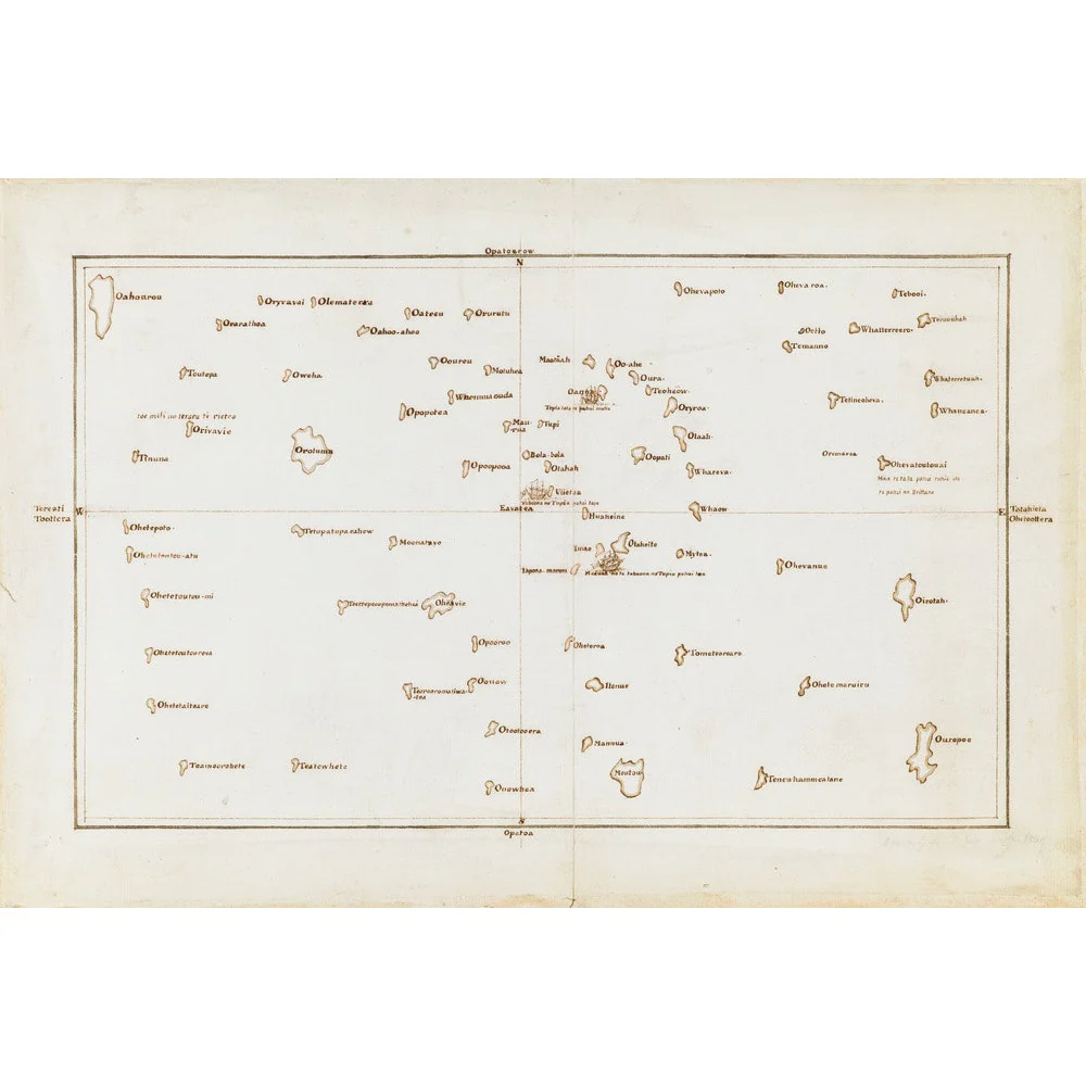
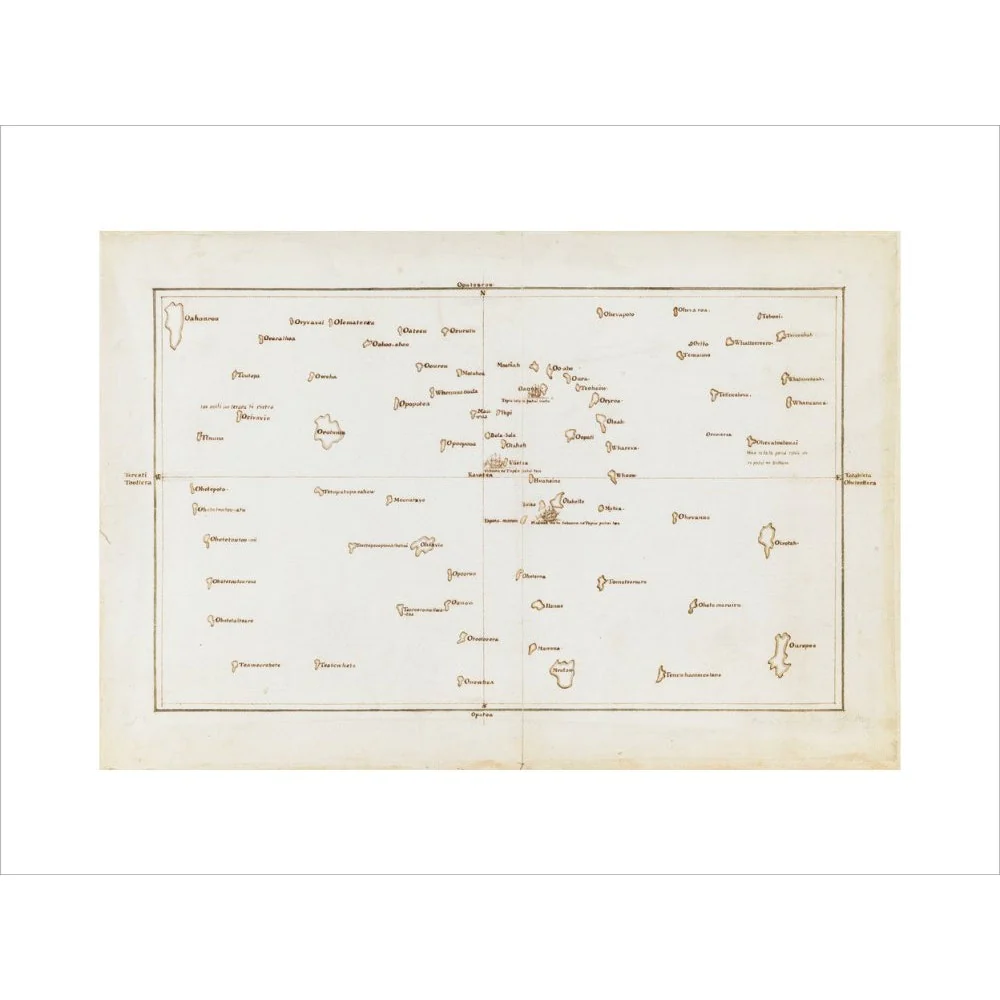
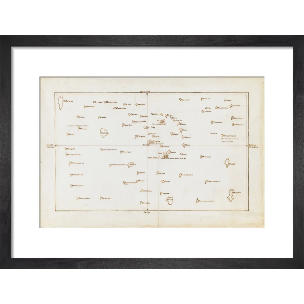

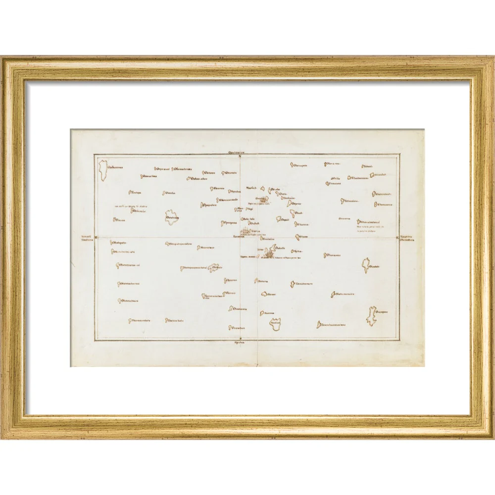
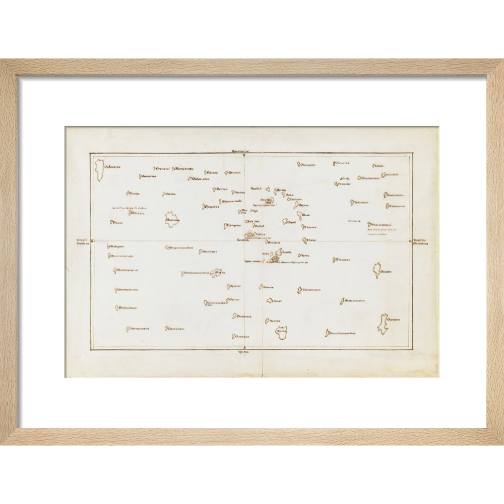
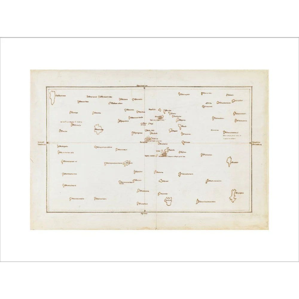
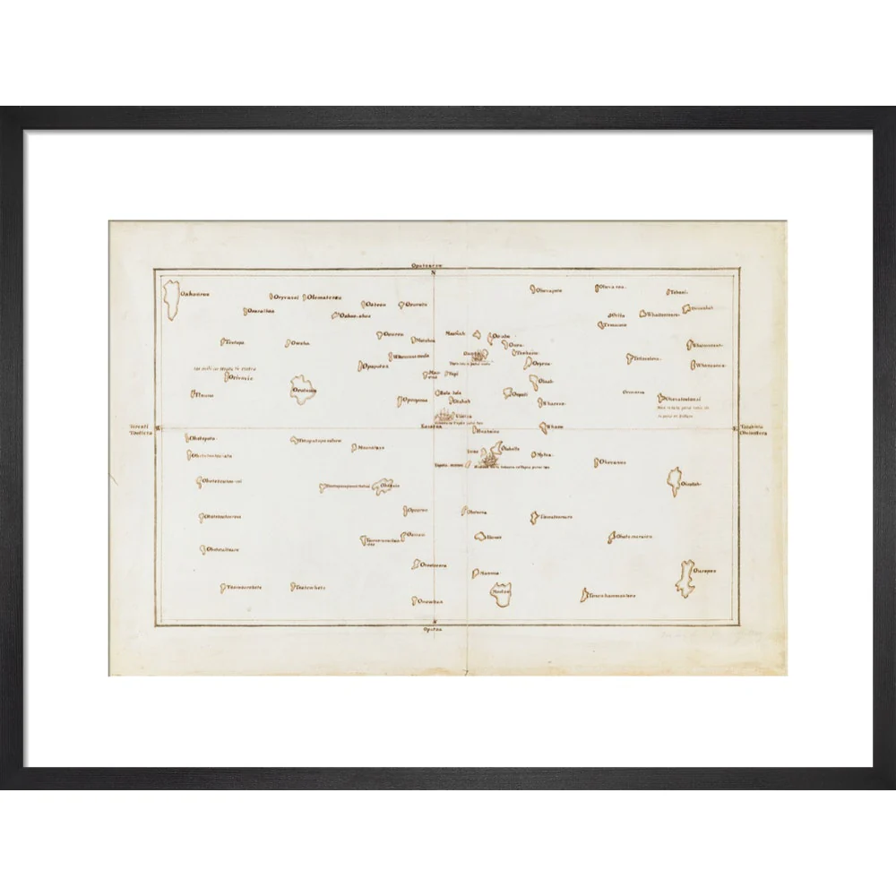
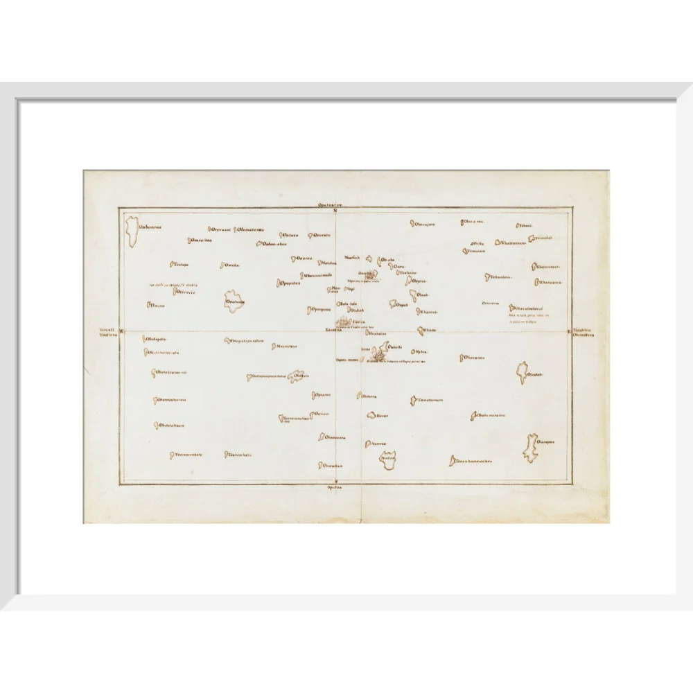
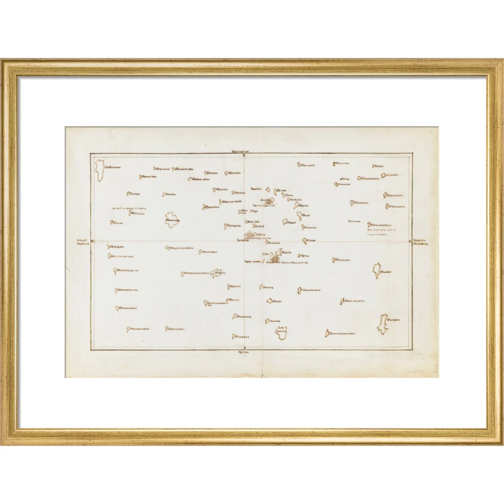
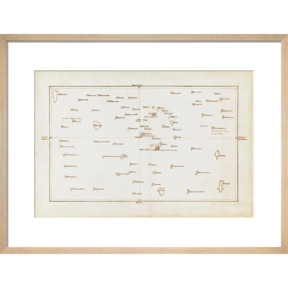

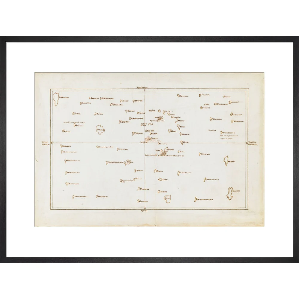
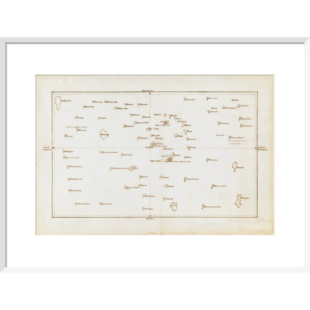
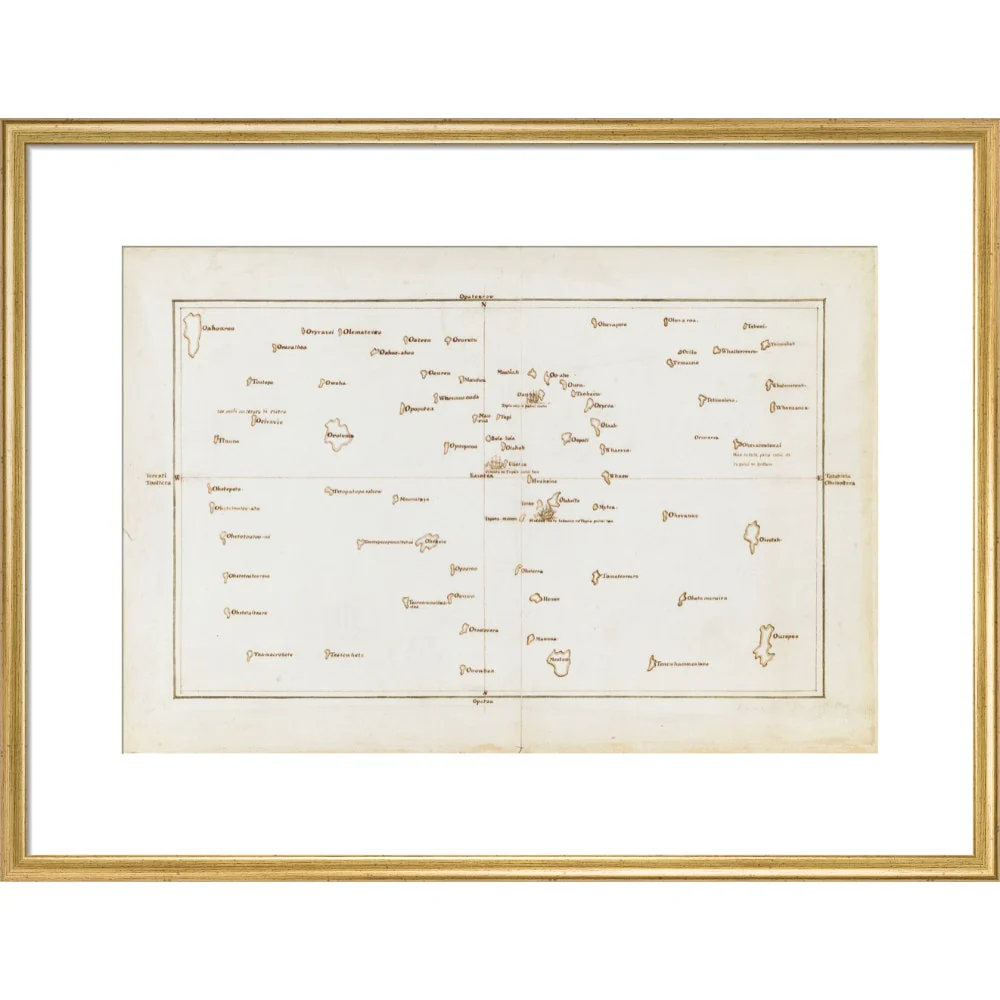
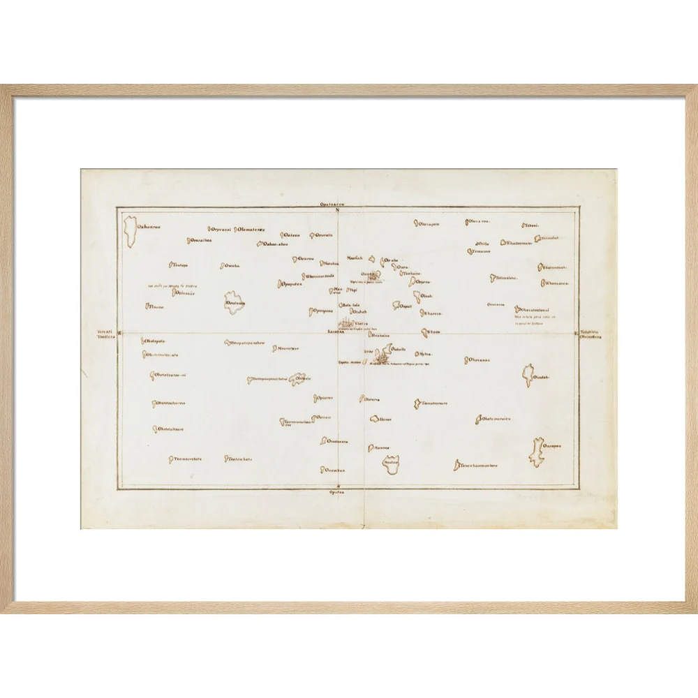
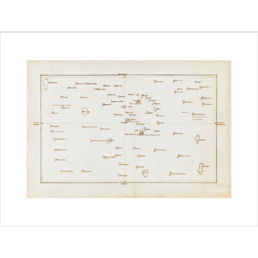
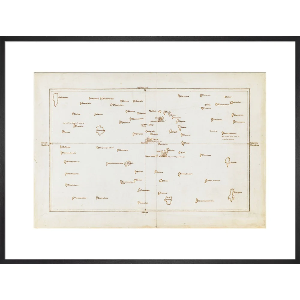
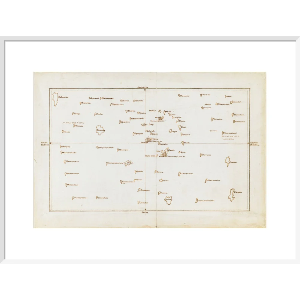
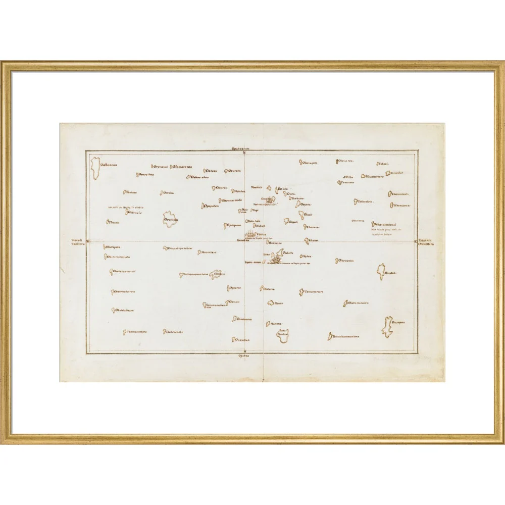
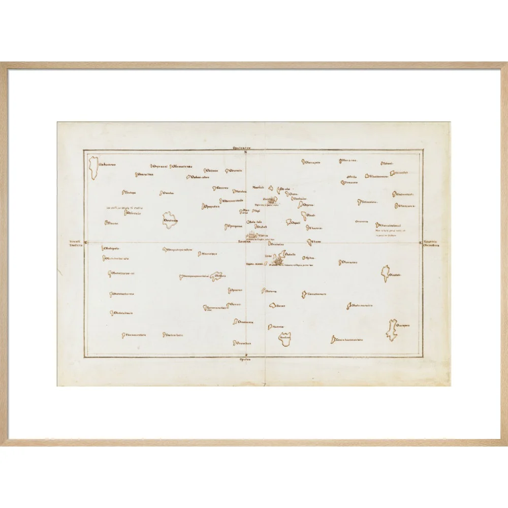
Chart of the Society Islands print
Chart of the Society Islands print
Chart of the Society Islands, with Otaheite [Tahiti] in the centre. July-August 1769.
This is a view of the Society Islands by Captain James Cook, who completed his first exploration of the Pacific Ocean from 1769 to 1771. The chart is a copy of an original document by Tupaia, a priest and leader of the island of Ra’iatea. He was enlisted by Cook to navigate HMS Endeavour to New Zealand. Tupaia’s knowledge of the topography, coastline and environmental features of South Pacific islands were indispensable to the British. Polynesian navigators before him had been exploring the Pacific for hundreds of years, charting routes to islands, including New Zealand, from their homelands around Tahiti.
Taken from Charts and Maps made during the Voyage of Discovery in the South Pacific Ocean, by Captain James Cook, commander of the Endeavour, in 1769 and 1770.
Add. MS 21593 C
Creator: James Cook
Select Type
Select Size
Select Frame
From $11.84
Original: $33.84
-65%Chart of the Society Islands print—
$33.84
$11.84Product Information
Product Information
Shipping & Returns
Shipping & Returns
Description
Chart of the Society Islands, with Otaheite [Tahiti] in the centre. July-August 1769.
This is a view of the Society Islands by Captain James Cook, who completed his first exploration of the Pacific Ocean from 1769 to 1771. The chart is a copy of an original document by Tupaia, a priest and leader of the island of Ra’iatea. He was enlisted by Cook to navigate HMS Endeavour to New Zealand. Tupaia’s knowledge of the topography, coastline and environmental features of South Pacific islands were indispensable to the British. Polynesian navigators before him had been exploring the Pacific for hundreds of years, charting routes to islands, including New Zealand, from their homelands around Tahiti.
Taken from Charts and Maps made during the Voyage of Discovery in the South Pacific Ocean, by Captain James Cook, commander of the Endeavour, in 1769 and 1770.
Add. MS 21593 C
Creator: James Cook